Growing urbanization results in the expansion of impervious surfaces. An increase in these surfaces leads to a myriad of challenges and problems. Employment of geospatial solutions can provide stakeholders with tools to make informed decisions for managing and mitigating these effects. My project objective is to evaluate the impact of impervious surfaces on a city's watershed using multispectral satellite imagery and GIS analysis. Specifically, the influence of increase impermeable surfaces of the City of Edmonton's urban development within a 5-year period.
For the project, I used Sentinel-2 data of Edmonton for the years 2018 and 2023, with minimal cloud cover (less than 10%) for the summer months of June-July-August. Other data, such as high-resolution DEM in ASCII format, were also used. These data required initial processing. To streamline and automate the workflow, I created tools using Model Builder in ArcGIS Pro to efficiently process the data.
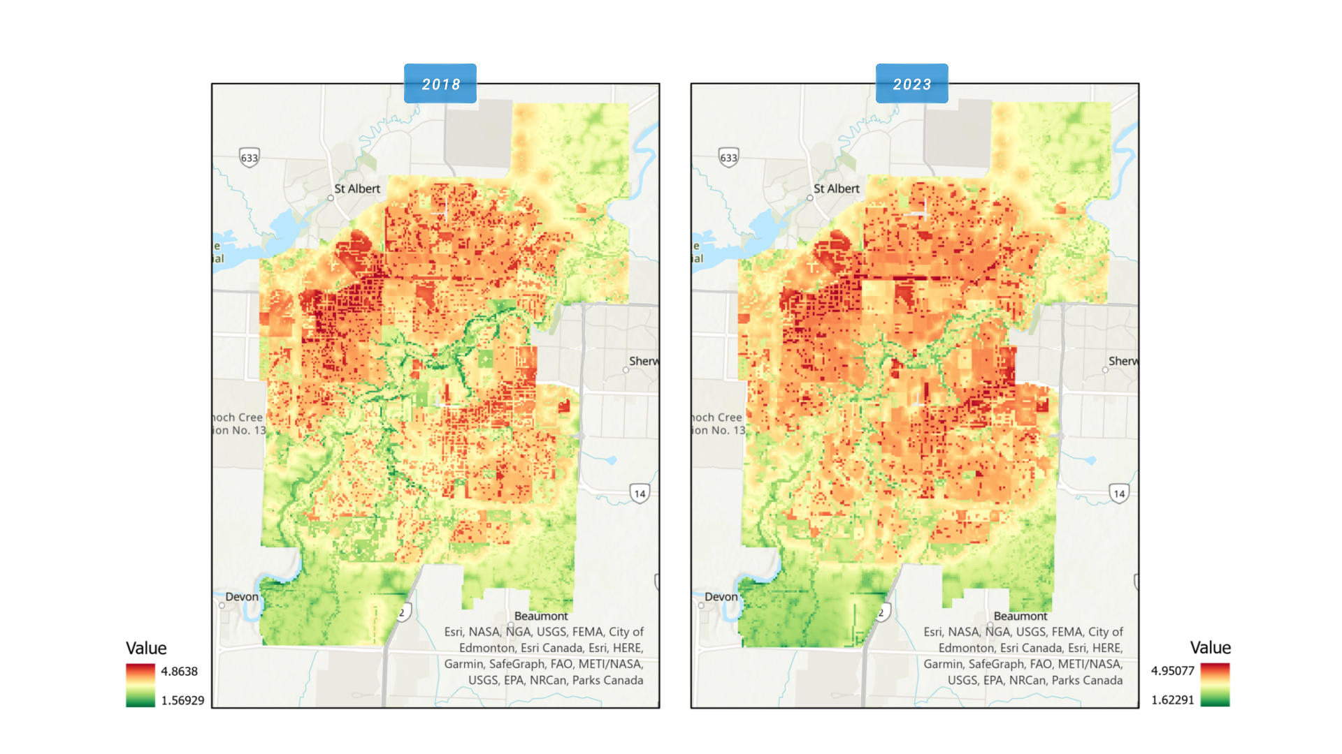
The analysis is done in three parts. First, mapping impervious surfaces by analyzing satellite data using the Image Classification Wizard in ArcGIS Pro. In both years, the model was trained with an average of 1,500+ training samples. The output maps from this analysis were then used in the next part. For more refined results, I would suggest increasing the number of training samples and using a higher image resolution.
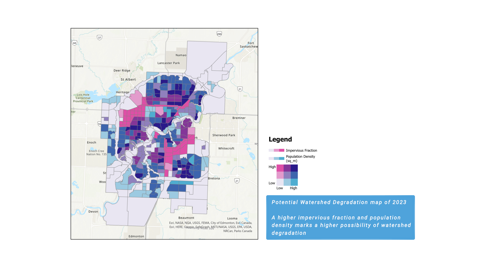
The second part involves using impervious surface maps and census tract-level population data of Edmonton to illustrate the potential watershed degradation. This maps out the areas that are at high risk and may need intervention, providing insights to policymakers for effective management of the city's watershed.
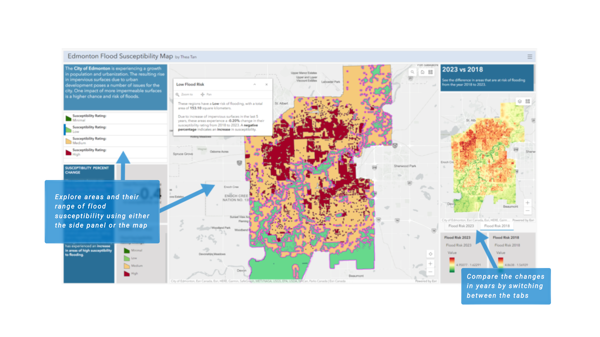
Lastly, I did an analysis to identify areas that are at risk of flooding due to impervious surfaces. Flood hazard mapping was completed using the Suitability Modeler in ArcGIS Pro, following a weighted suitability modeling worfklow. A dashboard was then created to visualize the results of this analysis and support stakeholders in their decision-making.
Given a limited time for this project, the study does not provide an exhaustive analysis. However, it effectively demonstrates the potential of satellite data and GIS for conducting impact assessment. The application of geospatial analyses and GIS technologies can help in addressing the effects of urban development on our environment and our lives.