Streetlighting is an essential utility of any city, and efficient management of its system is crucial. Cities like the City of Edmonton can benefit from various GIS tools and technologies in maintaining and developing of these assets. My project aimed to provide a GIS-based solution for monitoring and managing of Edmonton's streetlight network. Particularly, my goals were to:
Evaluate and update the current streetlight inventory of the city
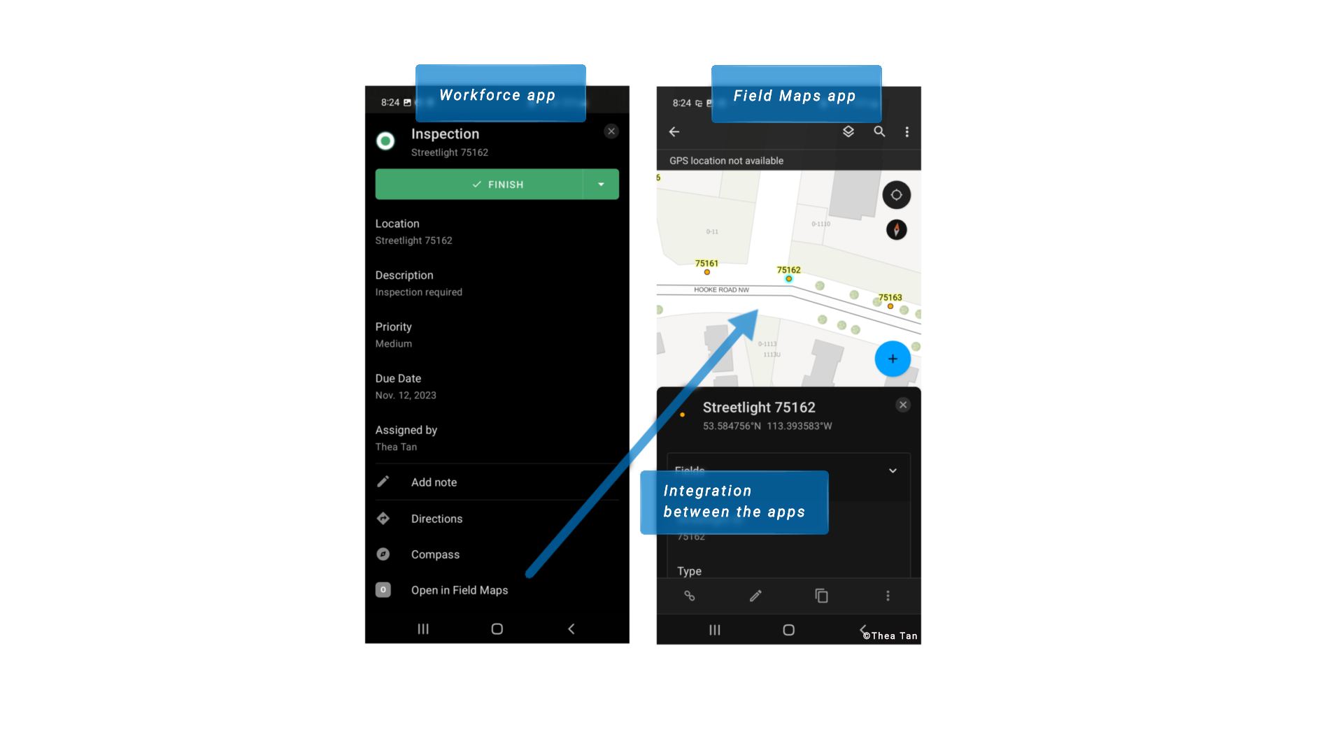
Employ ArcGIS Workforce solution for work order assignments, staff management, and coordination with other utilities
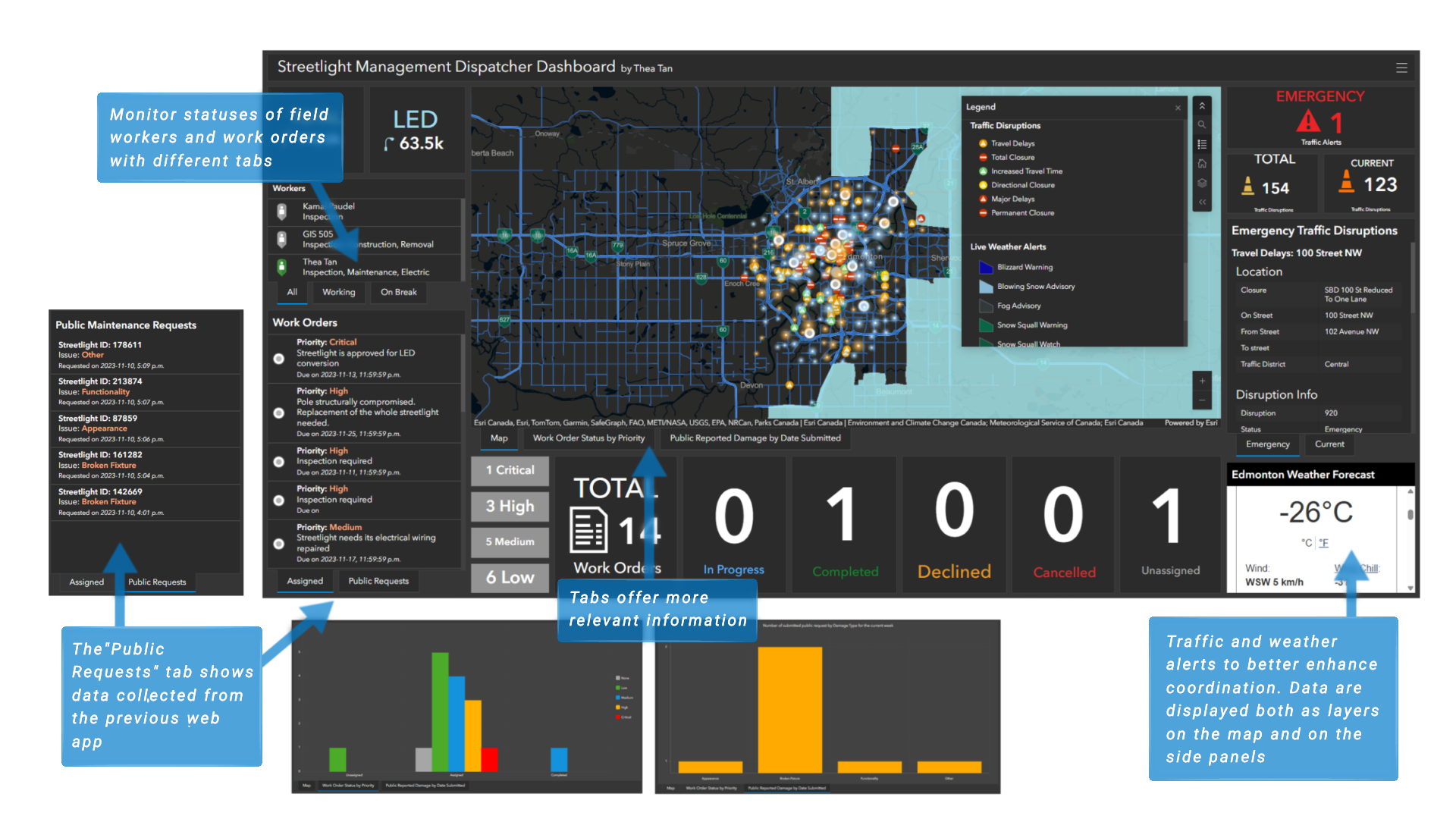
Provide a visualization of the city's streetlight network through ArcGIS Dashboard
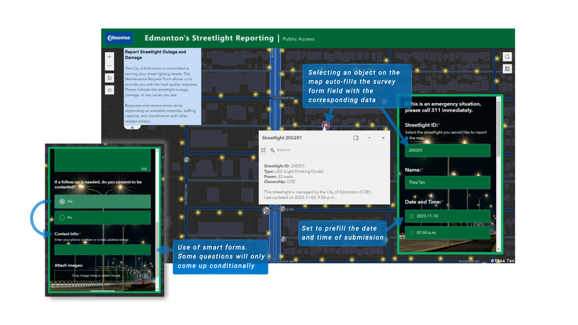
My management solution involved data collection, work coordination, and real-time monitoring using several GIS tools. I created a web application integrated with a Survey123 form to provide the public with a way to report damages or submit maintenance requests.
I utilized ArcGIS Workforce and Field Maps to manage the delivery of services. Enabling app integration ensures a seamless collaboration between field and office workers, resulting for an optimized workflow and productivity.
To monitor the entire network and field activities, I created a dispatcher management dashboard using ArcGIS Dashboard. I used the dispatcher map from Workforce, which contains multiple layers of primary and auxiliary data. The addition of weather and traffic data to the map enables dispatchers to monitor updates, prioritize work assignments, and coordinate with other utilities. A near-real-time traffic alert was achieved by scheduling and automating workflow in ArcGIS Pro and Online using daily updated source data. Live weather alerts from Environment and Climate Change Canada (ECCC) with a 15-minutes update frequency are added as a layer on the map.