This project complements my other course project, which you can read here. The objective is to demonstrate how GIS can support the expansion of EV charging stations in the City of Edmonton through geospatial analyses. A weighted suitability analysis was implemented to achieve this. Using the Suitability Modeler in ArcGIS Pro, I proposed five potential locations for developing a new charging station.
Below are the static maps I created for this project. Dynamic web maps versions of the following were also produced as deliverables for this project. They ensure stakeholders gain actionable insights and help make informed decisions in building an effective strategy for the future development of the current infrastructure.
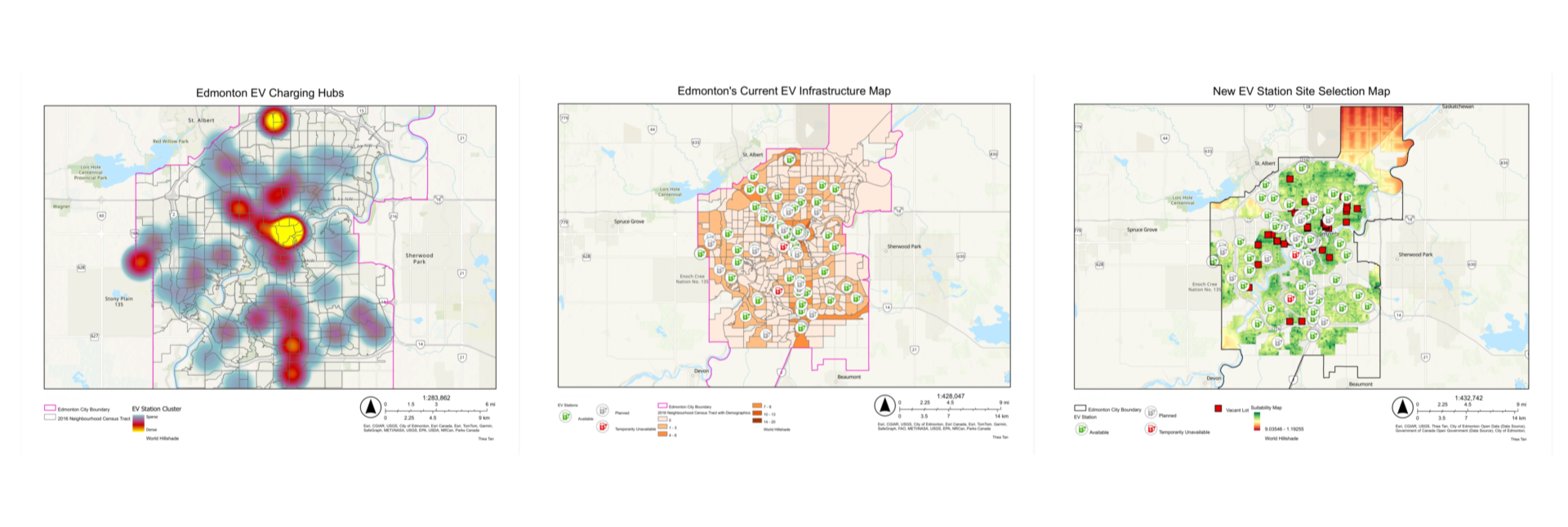
To further engage stakeholders, I designed a dashboard that showcases the five resulting favourable sites and other relevant data, such as neighbourhood and charging station information.